
I recently installed Skyview HDX in my 182 in Alaska.
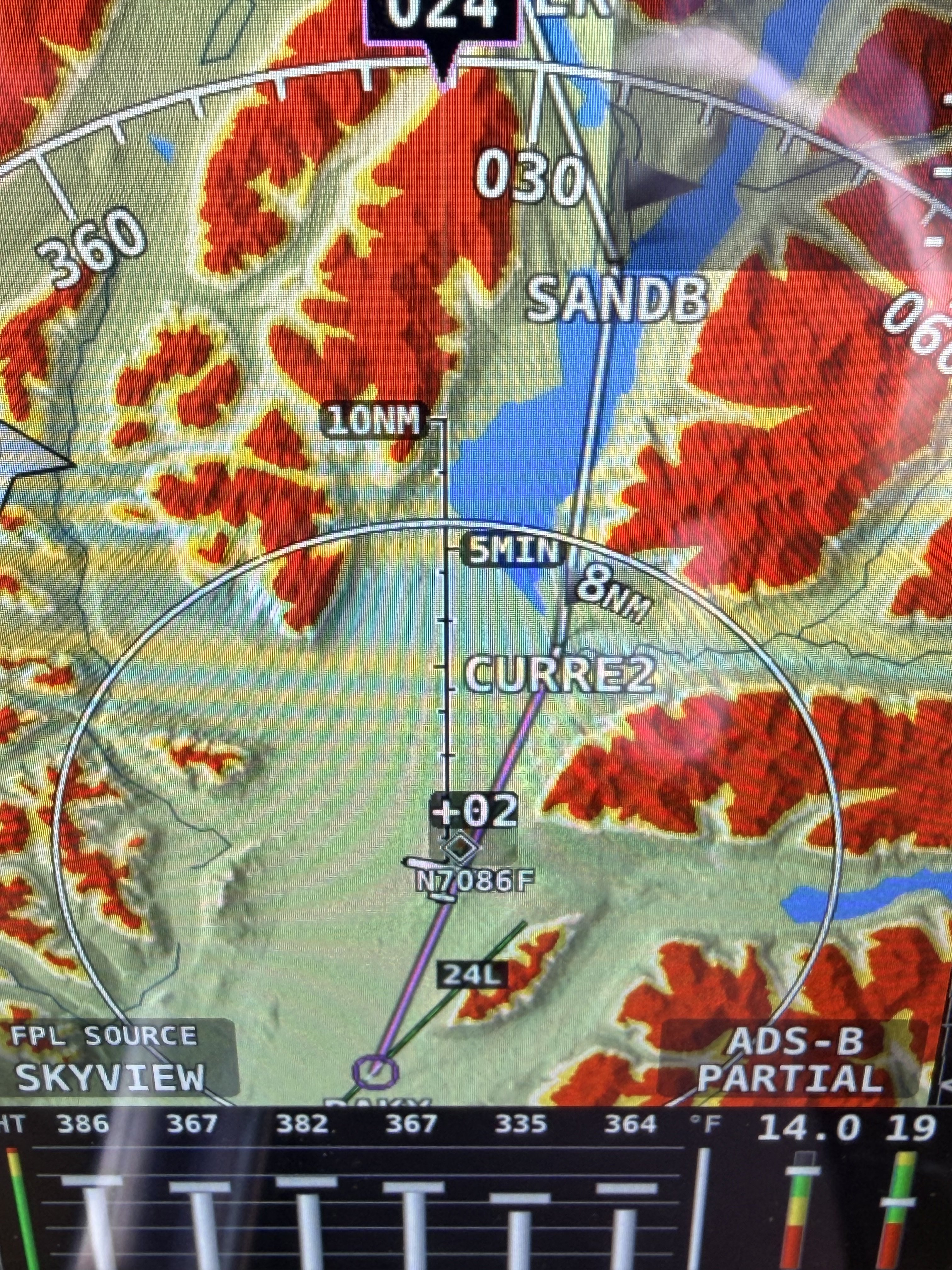
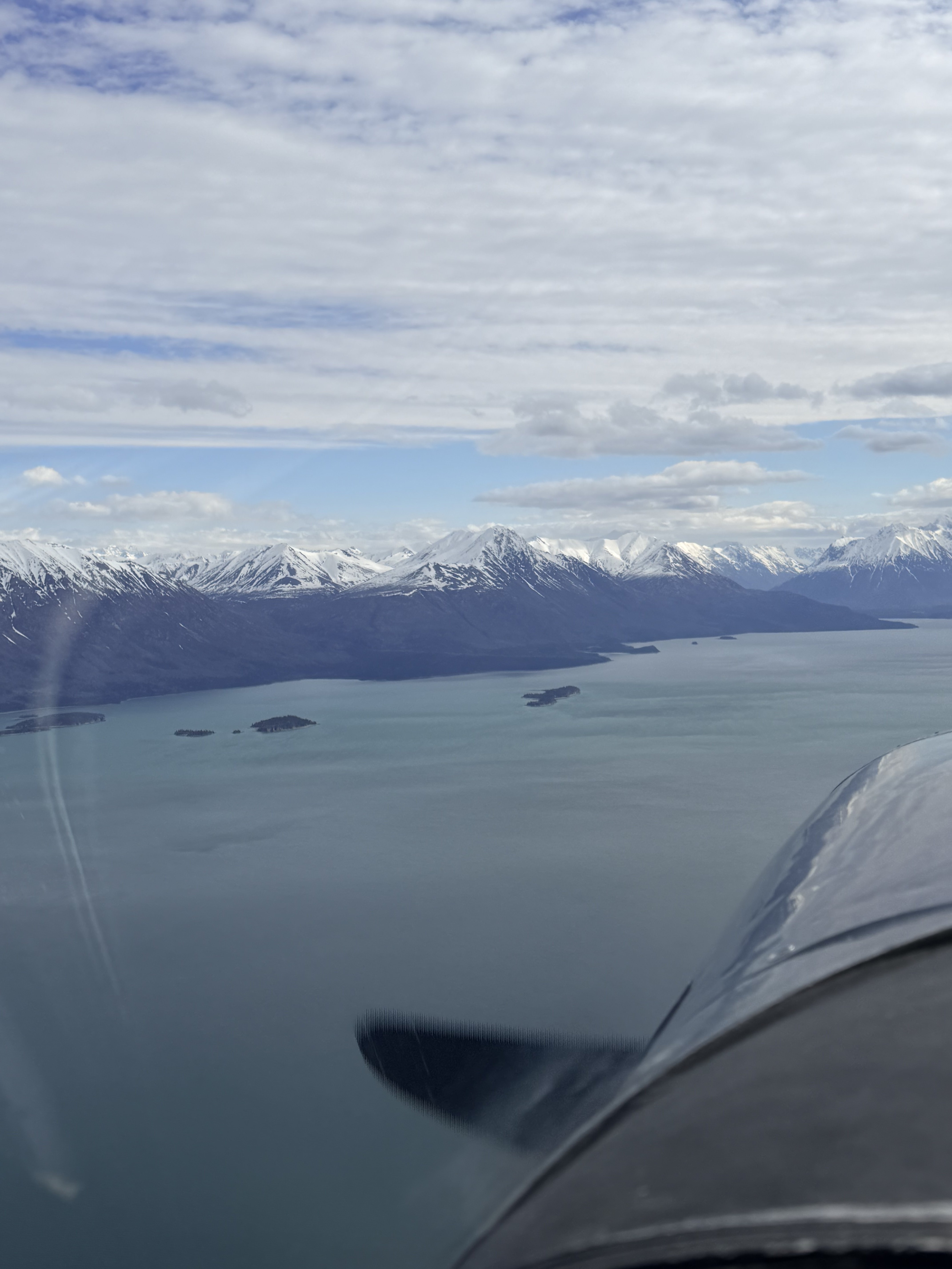
My first flight out into the mountains, I found a discrepancy between what the map shows and reality.
Who should I contact about this?
Map View:
Reality:
Sectional Chart:
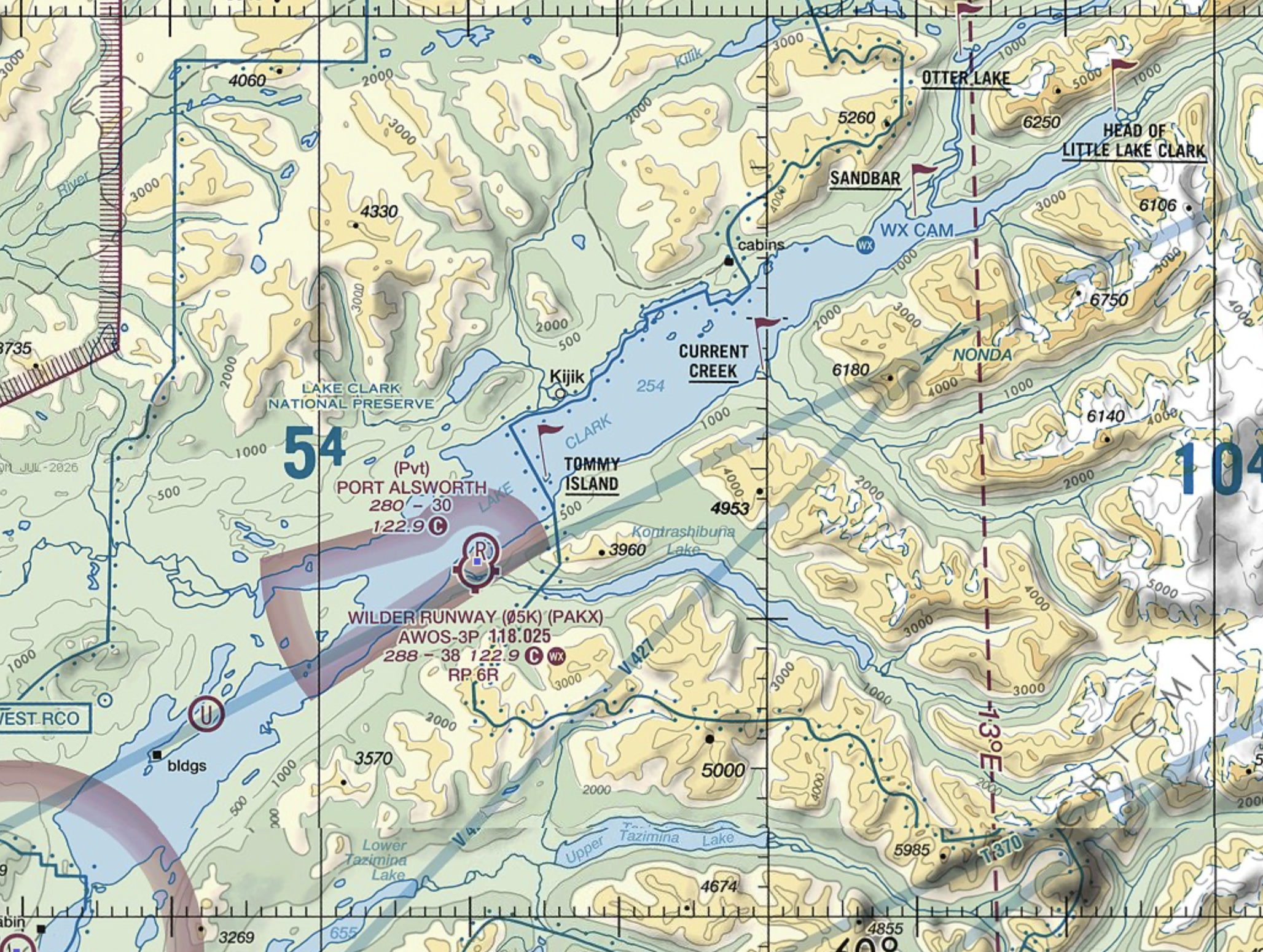
I was over Tommy Island when I took the pictures.
The lake continues another 20 miles behind me without a lake depicted on the Skyview map.
My first flight out into the mountains, I found a discrepancy between what the map shows and reality.
Who should I contact about this?
Map View:
Reality:
Sectional Chart:
I was over Tommy Island when I took the pictures.
The lake continues another 20 miles behind me without a lake depicted on the Skyview map.
