Feature Requests

jc2da

New Member
Joined
Dec 21, 2009
Messages
279
On my last flight, while i am sitting there whittling away the time, i thought of a couple of suggestions that others might like, too.

1. Displaying a name instead of just identifiers.

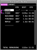
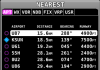
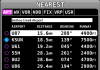
In the NRST page, all the airports and vors are listed by ID. However, sometimes it would be nice to see what the actual name of the airport or VOR is without having to hit INFO just to see the name.

It would only require a single line at the top, that displays the full name of the highlighted identifier. thus, if i hit NRST, i can just easily scroll down the list to see each full name quickly without using INFO.

2. Button combo to go to the top of the nav menu.

Because keys are limited, what about using a simple key combo to allow us to get to the top set of menus instead of having to hit back multiple times.

I was in AUTOPILOT -> PITCH page somewhere. If i want to look up an airport, i have to hit BACK -> BACK -> MAP -> INFO. It would be great though if i could just do KEY COMBO -> MAP -> INFO. 1 extra key doesn't seem like a lot, but I might do this multiple times a flight, going back and forth from MAP to AUTOPILOT to PFD, etc. Thus, really, it could save me dozens of key presses on a single flight.

Thoughts?

Jae
 

preid

Member
Joined
Jan 22, 2010
Messages
754
Location
SoCal
I expect #1 will be resolved in 7.0 release, per the announcement " When an item or airspace is selected with the map pointer, it is both highlighted on-screen and accompanied by a useful data block that shows relevant information about the feature - all without any additional button pushing."

I would think when I cursor over a airport it will tell me the name of that airport, since I already know the identifier from the MAP view.
 

N100MG

I love flying!
Joined
Aug 3, 2012
Messages
3
I haven't seen too many requests for extended centerlines on a destination airport. That is a great feature I use a lot on my Garmin Aera and Foreflight for orientation to a new airport. It makes it so much easier to get lined up especially for a small grass strip that may be difficult to see until you are right on top of it.
 

flaude

New Member
Joined
Dec 3, 2010
Messages
80
I would also suggest that in the FPL when the list of the waypoint is displayed we could also have ETA. In Italy by exemple the ATC always ask a what time will you be on way point and very often this waypoint is not the next one but in 2 or 3 waypoints...

I also love the first #1
 

trevpond

New Member
Joined
Jul 26, 2010
Messages
270
Location
Nottinghamshire U.K.
I haven't seen too many requests for extended centerlines on a destination airport. That is a great feature I use a lot on my Garmin Aera and Foreflight for orientation to a new airport. It makes it so much easier to get lined up especially for a small grass strip that may be difficult to see until you are right on top of it.

I'm with you on this one Mike, this would certainly help when going somewhere new.

best regards


Trev ;D ;D
 

dynonsupport

Dynon Technical Support
Staff member
Joined
Mar 23, 2005
Messages
13,226
So the flight plan window looks like this, with ETE right on it. Is there a reason this is not what you want flaude?

We don't show the names on the nearest page since it's not wide enough to have a useful name on there. For Snohomish County all we could fit was SNOHOMI.
 

Attachments

  • FPLETE.png
    FPLETE.png
    39.3 KB · Views: 117
  • NRST.png
    NRST.png
    38.3 KB · Views: 112

jc2da

New Member
Joined
Dec 21, 2009
Messages
279
I meant something like this. Might as well use all the space that is available.
 

Attachments

  • NRST_001.png
    NRST_001.png
    41.3 KB · Views: 117

preid

Member
Joined
Jan 22, 2010
Messages
754
Location
SoCal
Jchang is definitely on to a great feature I would benefit from outside of my known areas.
I can see a reason to use this as well. When I need to make a quick decision and divert it would benefit me to see the name of a NRST so I can call that CTAF and use the correct name of the airport without needing to go searching for it. Yes, I have found a need for this in the past.
If easy enough to do, add it!
 

dynonsupport

Dynon Technical Support
Staff member
Joined
Mar 23, 2005
Messages
13,226
When you press INFO on any airport, you get the full name. The radio frequencies are on that page, so for the case of wondering what the right name is to talk on CTAF, that data is already all on the same page, since I assume you didn't magically know the correct CTAF frequency ;)

If what Jchang suggests is what people really want, then we're happy to add it to the list. I was just assuming you wanted to know the name of the airport before you scrolled onto it, not just for the currently selected airport. If seeing it just for the selected is enough, then that is likely easy.*

*Not promising this for any specific release at this point though.
 

jc2da

New Member
Joined
Dec 21, 2009
Messages
279
Cool! I think it would be a great way to minimize some really annoying button pushing for some really common tasks. I would think it would be for everyone's benefit, at least those flying in unfamiliar areas.
 

southtarnation

I love flying! Wiring, ...not so much.
Joined
Nov 6, 2012
Messages
50
If its just info for the highlighted airport and is shown at the top in the white box... There looks to be room to add 1 or 2 other fields too in that box. Like the freqs or elevation. I know its only one more button away but why not?
 

cperry

New Member
Joined
Feb 3, 2010
Messages
63
Location
Edmonton, AB
I'm up for displaying the name of the currently selected "nearest" airport as well. I've found that unless I already know it, I've got to find the airport designation on the moving map (if i can see it, fly with track up, somtimes its behind me), and then search for that in the nearest list to get the info I want...otherwise, I've been using direct-to, and entering the airport name...difficult in bumpy skies. It'd be pretty easy to scroll down the nearest list until I see the airport name I want on top, then press info or direct-to from there.
 

jc2da

New Member
Joined
Dec 21, 2009
Messages
279
Bump for item #2! :) Anybody else see value in #2 in the first post? IE a hot button for going to the top of the navigation tree, without having to hit the back button several times?
 

flaude

New Member
Joined
Dec 3, 2010
Messages
80
in the FPL menu we have ETE (so time in minute to the next waypoint) but it would be great to have it also in ETA (complete zulu time)

exemple: in Italie, the ATC want to know where you are but also when you will pass a certain waypoint. If the waypoint is the next one, no problem. If the waypoint is in three turning point you have to manually add by exemple :5 minutes + 13 minutes + 12 minutes to the actual zulu time. It is not always easy to answer him in 2 seconds. 11:47+5+ 13 +12 = 12:17. Easy in front the computer, not that easy in real flight

thank

Cannot send an image to the serveur
 
Top