Red Background on Map

jmurtagh13

I love flying!
Joined
Mar 6, 2013
Messages
36
Dynon,
While we're on the subject of TFRs, I fly within the Washington warning zone often and having that area such a dark red is a real hindrance.   Being able to adjust the intensity or at least reduce the intensity of the RED would be very helpful.  As it is now I have to turn TFRs off when I'm in that area.  The warning zone (the area outside of the DC SFRA) really does not need to be highlighted anyway.       

Read the thread on "DC SFRA" then download and install the  " TFR_ACTIVE_LIGHT.dfg" file.  This fixes the problem for us that have to fly near such nonsense.

Carl

Carl and Top Cat,

Thank you for your help, both these tips will make flying in the DC area much more pleasant :)

John
 

Dynon

Dynon Staff
Staff member
Joined
Jan 14, 2013
Messages
14,231
Location
Woodinville, WA
So a summary of what we know, and a few thoughts:

A couple of weeks ago, the 
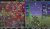
first reports of the enormous TFR over the east coast showed up on our forum. It took us some time to get a data log that contained it (we're in WA; TFRs are broadcast for the area near the transmitting ADS-B station), so we weren't initially sure what to make of it. During that uncertainty, it's possible that our technical support team jumped to the conclusion that there was a bug in SkyView. It's definitely the sort of thing that smells a bit like a software bug, but we don't think it's one inside of SkyView in this case.

What we know so far, as of right now:
  • The "TFRs" that people are seeing on the east coast are NOTAMs (actually, all TFRs are NOTAMs) that are being identified as TFRs by the bits in the ADS-B data stream that identify what type of information a particular record is.
  • Non-TFR NOTAMs are normally appropriately ignored by SkyView's TFR drawing. However, since these NOTAMs are being categorized as TFRs, they're displayed like other TFRs.
  • It looks like at least some other systems devices that receive TFRs over the ADS-B radio broadcast (UAT/978) are seeing the same thing.
  • It appears that programs and apps that get receive TFRs via an internet connection are not seeing this phenomenon, which is why some thought it to be a bug in SkyView.
  • The NOTAMs in question definitely aren't TFRs; It's not clear why they're tagged as TFRs. They seem to all have to do with outages the ADS-B system, which is we suspect why they're being treated differently than other non-TFR NOTAMs that are broadcast (just a hunch).
  • We're reaching out to other folks in the industry and the the FAA to figure out if this is by design, a categorization mistake, or something else.
  • Whether there are any adjustments to SkyView's software that might be appropriate are dependent on the above questions, and are still TBD.
  • In the meantime, you can reduce the visual prominence of these TFRs by turning down the interior opacity/shading of the TFRs in MAP MENU > MAP ITEMS > TFR OPACITY. If you go down to 0%, you'll have red outline similar to how other airspaces are depicted. You can also play with the zoom level that the TFRs are shown at in the same menu to affect when they're shown.

As for the other comments about various aspects of our company and support: First, thank you for speaking up. We try hard to support a fleet of thousands of aircraft that fly behind our products. I think we delight our customers most of the time. On rare occasion, we get it wrong or fall short of your expectations. I don't want to get into a public back and forth about individual cases, but if there's anything that we can do for any of you, please reach out to me in a PM for a more personal conversation.
 

Dynon

Dynon Staff
Staff member
Joined
Jan 14, 2013
Messages
14,231
Location
Woodinville, WA
A quick update here. We've been talking to the FAA and it's definitely an encoding issue on their end that they'll be looking into deeper and will fix.

This is the 3rd or 4th time that SkyView pilots have found problems with the ADS-B data or configuration of the system as a whole. Basically, you guys are probably the biggest daily users of both the In and Out side of the system at the moment. The experimental community is basically finding and clearing the glitches for the rest of the fleet's benefit after 2020 :). In fact we've often (including this time) been the only ones that let them know that there's a problem.
 

dorante

I love flying!
Joined
Apr 29, 2014
Messages
4
Here is a screenshot I took on 10 Dec just south of Washington DC SFRA. The East Coast ADSB Notam/TFR was visible.

I uploaded to Dynon the diagnostic file from that flight and the attached screenshot file on 19 Dec.

QUESTION to DYNON: Notice the horizontal "stripes" (e.g. at KOMH). Have you seen this before? Are these associated with this TFR problem?
 

Attachments

  • screenshot-N716RV-SN06151-13_0_3_3233-20151210-140106-422-en_US.png
    screenshot-N716RV-SN06151-13_0_3_3233-20151210-140106-422-en_US.png
    676.5 KB · Views: 133

dynonsupport

Dynon Technical Support
Staff member
Joined
Mar 23, 2005
Messages
13,226
You have weather turned on. The purple areas are ones which we don't have NEXRAD for yet. The clear areas are places we do. It gets transmitted in stripes and chunks, so this is not unusual especially right after you depart, and should have cleared up within 5 minutes.
 

dorante

I love flying!
Joined
Apr 29, 2014
Messages
4
Thanks. Learn something every day.

Sorry to see you working at 1810 on a Saturday, but thanks for the wonderful tech support.
 

dynonsupport

Dynon Technical Support
Staff member
Joined
Mar 23, 2005
Messages
13,226
To close the book on this:

The FAA has investigated and found they did improperly uplink a "SPECIAL NOTICE" NOTAM as a TFR. Dynon's system received a TFR over ADS-B with no way to tell it was anything but. On top of this, there was an error in the transmitted data with one of the points of the outline being over near Africa instead of in Florida. This caused different mapping systems to draw it differently (including not drawing it at all).

The error was only in ADS-B uplinks. Any device that got it's data any off the internet would not have seen this or if you called Flight Service they would not have had it as a TFR either.

One element that made this situation more obvious on SkyView than other systems is that our default settings shade the inside of TFR's red to make it clear you are inside a TFR. SkyView does have a TFR opacity adjustment in the map settings. If you prefer to only see outlines of TFRs and not have the interior shaded, you can adjust this to zero at any time. The outlines of the TFR will remain in red.

We're sorry that this caused confusion among our customers, but in reviewing what happened here, there is no way for Dynon to protect against showing a TFR like this when ADS-B tells us it's there.

--Ian @ Dynon

P.S. Thanks to everyone that helped us and the FAA identify and get to the root cause of this issue. With your datalogs, we were able to give the FAA the exact data they had sent over ADS-B and quickly demonstrate that the issue was in the raw ADS-B data.
 
Top