You are using an out of date browser. It may not display this or other websites correctly.
You should upgrade or use an alternative browser.
You should upgrade or use an alternative browser.
Synthetic Vision
- Thread starter Dw1oakes
- Start date
- Joined
- Mar 23, 2005
- Messages
- 13,226
Sounds like you should fly somewhere that has hills or lakes (or obstacles)... They're already on there!
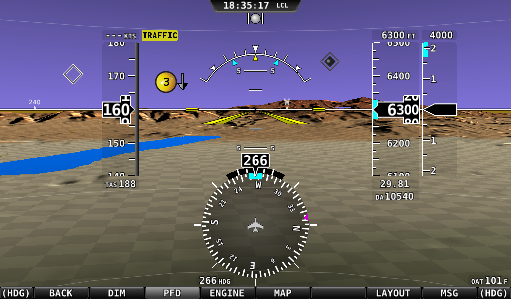
Here's a screen shot from a real SkyView from back in 2010:
And here's New York City:

Here's a screen shot from a real SkyView from back in 2010:
And here's New York City:
airguy
Well-Known Member
Dynon - the borders of your bodies of water - are those at some historical "snapshot" in time or are they floodstage or conservation stage or something else?
- Joined
- Mar 23, 2005
- Messages
- 13,226
They are generally at a flood level for inland water.
jnmeade
Active Member
I spent a lot of time flying synthetic vision at the OPL in Iowa City when Prof Schnell and crew were developing this kind of idea. We flew all kinds of backgrounds, including the squares of different sizes and colors, other shapes, some kind of wire net look and others. The squares was chosen as the result of testing which indicated it was preferable. There were a lot of eye motion studies involved and lots of repetitive flights changing only the background.
I guess I must fly somewhere there is hills or something as I get nothing. Drat that midwest scenery. I do not even get large lakes, I would have thought a reservoir would have shown. Would i have missed something in the set up?
Thanks
Dave :-?
Thanks
Dave :-?
jnmeade
Active Member
I don't know how bodies of water are depicted. When I was doing a lot of primary instruction, I used to caution the students about relying on the shape of bodies of water to verify a checkpoint. Dams don't move, but the lake gets big and small, changes shape and otherwise is untrustworthy. If you are in Minnesota, it can be downright confusing. ")
mmarien
Murray M.
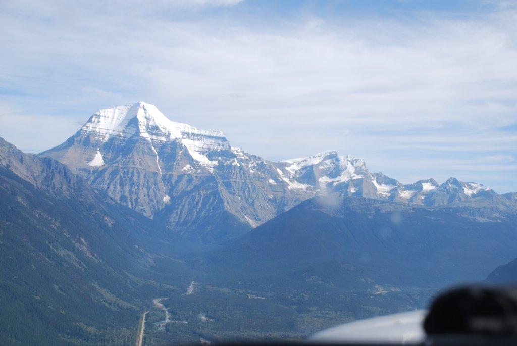
Synthetic vision verses the real thing:

jakej
Well-Known Member
Just love those snow capped mountains ;D
Jake J
Jake J
- Joined
- Mar 23, 2005
- Messages
- 13,226
Only two minor issues:
1) Google map images are about 20,000 Terrabytes. With current 4TB hard drives, that would only weigh about 6,000 pounds and draw 70 HP of electricity to keep running Plus costing $1M.
2) The more real reason is that aerial images are far from free. Licensing a whole country of images isn't something that is generally in the budget of an experimental plane. While it appears that things like Google maps are free, the aren't if you want to use them commercially.
1) Google map images are about 20,000 Terrabytes. With current 4TB hard drives, that would only weigh about 6,000 pounds and draw 70 HP of electricity to keep running
Plus costing $1M.2) The more real reason is that aerial images are far from free. Licensing a whole country of images isn't something that is generally in the budget of an experimental plane. While it appears that things like Google maps are free, the aren't if you want to use them commercially.