Help: terrain warning altitude suddenly way off

RandomSquawk

Member
Joined
Jul 17, 2020
Messages
30
Periodically I compare my terrain warning altitudes/colors against reality. I don't use it for nav, but it's comforting to know that it's there, since I fly in the mountains a lot. Terrain warning altitudes have been fairly accurate for years, but last weekend it was dangerously far off, and I don't know why the sudden change. As configured (and verified) I usually have to climb 400 feet above terrain before it goes from red to yellow. For 2 days I saw repeated events where terrain that was actually still above me showing as yellow on the map.

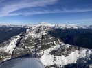
In this photo collage, I tried to capture one example. #1 and #2 (crops of the same image) were taken the moment that all red vanished from the map. The mountain peak to my left is clearly still above me. #3 was taken 4 seconds earlier (and 40 feet lower), when the map still showed a hint of red. The baro-altimeter, the photo (#1), an external GPS, and the USGS reported peak height all mostly agree. I should have had to climb another ~500 feet before the map went from red to yellow. EDIT: the map zoom/ring is set to 2nm, which is typical in this situation.

I'm trying to think of all the things that could influence this outcome.

terrain warning color issue.jpg
 

Rhino

Well-Known Member
Joined
Jul 20, 2009
Messages
1,292
Have you updated charts recently? The terrain chart may have had issues. I'd download and install it again.
 

RandomSquawk

Member
Joined
Jul 17, 2020
Messages
30
Have you updated charts recently? The terrain chart may have had issues. I'd download and install it again.
A few weeks ago. That's perhaps more recent than my previous validation pass. New data comes out in a few days. Will be interesting to see. Also, I think I want to enable the GPS Altitude display next time, so I can compare it to the rest.
 

Marc_J._Zeitlin

Active Member
Joined
Sep 24, 2007
Messages
255
Location
Tehachapi, CA 93561
...#1 and #2 (crops of the same image) were taken the moment that all red vanished from the map. The mountain peak to my left is clearly still above me....
Well, with all due respect, I fly in the mountains all the time too, and there is exactly zero way for you to say categorically that the mountain off to your left is "clearly still above you". In mountainous terrain, there is no "horizon", so you don't know what's at your level, what's above you, and what's below you unless you're VERY close to it. I have flown over ridges that from 5 - 10 miles away I would have sworn were above my altitude, but when I get there, I'm 500 - 1000 ft. above the ridge.

I'm going to guess that that's what's going on here. Optical illusion - very common. Unless you've flown next to THAT mountain before, and had a warning previously and didn't get one this time, that's the way I'd bet.

I'm also sure that's not what you wanted someone to tell you :).
 

RandomSquawk

Member
Joined
Jul 17, 2020
Messages
30
Well, with all due respect, I fly in the mountains all the time too, and there is exactly zero way for you to say categorically that the mountain off to your left is "clearly still above you". In mountainous terrain, there is no "horizon", so you don't know what's at your level, what's above you, and what's below you unless you're VERY close to it. I have flown over ridges that from 5 - 10 miles away I would have sworn were above my altitude, but when I get there, I'm 500 - 1000 ft. above the ridge.

I'm going to guess that that's what's going on here. Optical illusion - very common. Unless you've flown next to THAT mountain before, and had a warning previously and didn't get one this time, that's the way I'd bet.

I'm also sure that's not what you wanted someone to tell you :).
Indeed I have flown up next to that mountain (Sloan Peak) many times, and a dozen other peaks in the vicinity. It's kind of my back yard. As I said, this scenario played out repeatedly over the weekend. Sorry the photo angle above is a compromise of trying to capture everything I could at just the right timing. What you don't see, blocked from view, is the even taller Cascade Mountain Range just beyond. Illusion discussion aside, multiple, independent altitude indicators say I'm at just below the peak. Only the alert shading says otherwise, and it differs by ~450 feet. For reference, here's another pic taken 27 seconds later, and a little higher.

IMG_5984.JPG
 

Rhino

Well-Known Member
Joined
Jul 20, 2009
Messages
1,292
Sloan is 7,835 feet. So, unless all his altitude indicators were wrong, he was below the peak. I would still suspect the obstacle database as the culprit here.
 

Marc_J._Zeitlin

Active Member
Joined
Sep 24, 2007
Messages
255
Location
Tehachapi, CA 93561
Sloan is 7,835 feet. So, unless all his altitude indicators were wrong, he was below the peak. I would still suspect the obstacle database as the culprit here.
You both realize, of course, that the altitude displayed in the first pic is the barometric altitude and that the terrain warning is based on GPS altitude, right? Because that's what's in the terrain database? And that with a barometer setting of an extremely high 30.45 in-Hg, it's not surprising that the barometric altitude and the GPS altitude will be off by many hundreds of feet. With a baro setting that high, the altimeter(s) will THINK that you're lower than you would be at a lower baro setting. But the GPS altitude is what it always is, so the difference will be larger.

GPS altitude IS one of the things that can be shown in the map info column (and you can check it in the data download to see just what the differences were), but it's not shown here in the first picture, so there's no way to know (from the info given) just how different the GPS and Baro altitudes were.

So aside from the illusion issue (which the picture in post #5 does nothing to alleviate - could be above, even with or below the peak), I'm going to guess that the very high baro setting and the difference between baro and GPS altitudes is why sometimes you get the warning and sometimes you don't.
 

Rhino

Well-Known Member
Joined
Jul 20, 2009
Messages
1,292
You both realize, of course, that the altitude displayed in the first pic is the barometric altitude and that the terrain warning is based on GPS altitude, right? Because that's what's in the terrain database?
Yes. As I said, unless all his altitude indicators were wrong. I was in no way discounting the possibility of a GPS differentiation error. But since he apparently has regularly flown this area for some time, since this problem has just now appeared, and since it happened over two days where presumably the baro setting also changed, I think he has valid reason to suspect there's a problem somewhere. Since it closely coincides with the most recent database update, I still lean in that direction.
 

Marc_J._Zeitlin

Active Member
Joined
Sep 24, 2007
Messages
255
Location
Tehachapi, CA 93561
Yes. As I said, unless all his altitude indicators were wrong.
They're not "wrong". They're just measuring something different than GPS altitude, which is what matters in this case. Now, along with the relatively extreme baro setting, maybe there was a GPS anomaly in that area - the DD could have been screwing with something, or who knows what. That could also cause a major difference. The first place I'd look would NOT be a database error. Anything's possible, of course, but it wouldn't be the first place I'd look.
 

RVDan

I love flying!
Joined
Aug 8, 2012
Messages
279
Location
Frederick, MD
My look at the map photos shows a yellow terrain depiction with a red spot. Looks like that could be your mountain peak?
 

RandomSquawk

Member
Joined
Jul 17, 2020
Messages
30
I was starting to regret posting a pic at all, but the discussion did lead me to think deeper. I then realized I do have the Dynon GPS data. It's in the EFIS data logs that I download and keep forever. Using Zulu time from the EFIS image (21:17:42) I searched the log. It recorded 7740 GPS Alt at that moment. Even if I expand to the 40 data samples in the surrounding 10 second period, the highest recorded value is 7794. So, dead end.

Time to focus on other things that affect EFIS visuals, like terrain data, display logic, zoom level, etc.


RVDan, to your question: there are multiple inset photos that show the peak. One is red (for reference), one is not, and I made the unfortunate choice to number them backwards. :rolleyes: Like I said, I kinda regret putting in a photo.
 

Dynon

Dynon Staff
Staff member
Joined
Jan 14, 2013
Messages
14,221
Location
Woodinville, WA
A few things:

The terrain data doesn't update with any of the routine database updates. It's solely tied to the 4gb files here. https://dynonavionics.com/basemap-terrain-data.php. You'll notice they haven't been updated in a decade, because Terrain doesn't really change. Well admittedly, if Mt Rainier gets jealous of St. Helens and pops some day, we'll need to.

The terrain data probably isn't absolutely perfect. We used a variety of data sources to compile our databases, and the 2013 editions are an improvement over the prior. But probably not absolutely perfect.

Hard to tell without seeing the orientation, but the yellow/red spot right below your number looks to be a mile away, and that's what the picture shows what's presumably out the left window.
 

Albee

New Member
Joined
Mar 19, 2021
Messages
27
Location
Florida & Georgia
Looking back at the pilot users manual to make sure, with the default settings red is supposed to indicate terrain from 100 ft below GPS altitude and above, yellow from 1000 ft below GPS altitude to 100 feet below. I pulled up the USGS topo map for Sloan Peak and the area above 7600 feet is going to be tiny--which appears to be whats on the display. That's a very sharp peak; even the area above 6700 feet is quite small, also consistent with the yellow on the display. So it may be different than you're used to seeing, but the red and yellow patches are what I'd expect.

You said in the past you've seen red for terrain 400 feet below you, so I'll suggest two theories:

(1) Have you had the terrain proximity settings different from default, and somehow (perhaps in a recent update?) they got reset to default? I've never messed with those settings myself, but the installation guide says they can be changed (therefore viewed) in the MAP SETUP page.

(2) Is is possible in the past when you've checked the colors against what you see, the GPS altitude was ~400 feet lower than baro? In the picture your baro altititude is 7820, if the times match GPS from your log is 80 feet lower than baro. I routinely see 200-300 foot difference between baro and GPS altitude, and sometimes larger differences at altitude. I have no idea how WAAS GPS could be that far off when it's so accurate horizontally I could taxi with it. But I never really paid much attention to GPS altitude until this thread.

As an aside, how about a few of you look over any records you have of Baro and GPS altitude differences and we see how big those are in the wild? I quickly found a picture from August 23rd near DFW showing baro 9,590, GPS 10,291. That's nearly 700 feet of difference! It's possible GPS altitude is "expected" to be different, usually in some predictable way having to do with geoid models & such, but if it is I think we need to understand that before paying any attention to terrain and obstruction warnings!
 

RandomSquawk

Member
Joined
Jul 17, 2020
Messages
30
...Hard to tell without seeing the orientation, but the yellow/red spot right below your number looks to be a mile away, and that's what the picture shows what's presumably out the left window....
Correct.

...(1) Have you had the terrain proximity settings different from default...? ...
Yes, years ago I set them to 400 and 800. I'll have to go back and look to be absolutely sure they're still set that way but user_config.dfg exported a few weeks ago contains this:
terr_on=1
terr_red=400
terr_yellow=800

...(2) Is is possible in the past when you've checked the colors against what you see, the GPS altitude was ~400 feet lower than baro? In the picture your baro altititude is 7820, if the times match GPS from your log is 80 feet lower than baro. I routinely see 200-300 foot difference between baro and GPS altitude, and sometimes larger differences at altitude. ...
Tough to know, since expected behavior isn't a cause for hitting the record button. As you pointed out, it does vary a bit, which is why I raised the red level to 400. That had previously exceeded any error I witnessed. I'm going to be paying a lot closer attention for the next few flights, and have sync'd cameras pointed at everything.

...As an aside, how about a few of you look over any records you have of Baro and GPS altitude differences and we see how big those are in the wild? I quickly found a picture from August 23rd near DFW showing baro 9,590, GPS 10,291. That's nearly 700 feet of difference! ...
Yikes, 700 is colossal! The HDX only records pressure altitude, which bugs me, but I sort of get why they do it. Manually converting a few data points is one thing, but I don't have an easy way to compare a bunch or scan for historical trends and outliers. I've considered hosting my own SQL Database and importing all 430 hours (~6 million data points). I could go nuts with analysis then, but I'm almost afraid of what else I might find. Also, that's too much like my day job. I wonder if Dynon needs a SQL guy.... :p
 

Albee

New Member
Joined
Mar 19, 2021
Messages
27
Location
Florida & Georgia
That particular day I was just outside the DFW class B, with a current altimeter setting and tuned to Approach. I could hear myself being called out to other traffic at the correct altitude and my transponder uses a dedicated encoder for altitude, not the Dynon ADAHRS. I was on the home stretch of a 4000 mile trip with landings at 6000 ft fields and my baro altitude matched field elevations all the way, within about 30 feet. So I trust my baro.

Until GPS came along we all merrily assumed baro altitude was "real altitude"; I and everyone I know didn't clearly appreciate that GPS tells us something rather different. One of my last real jobs before I became a full-time manager lead me to realize that there are more flavors of "altitude" than there are of "speed". Unlike aviation speeds, I was never able to get a clear map of all the altitude relationships because each is seems to be the favorite invention of a specific community and those communities don't seem to care what the others are doing. For example, "geopotential altitude" isn't linear--10,000 feet to 10,001 feet isn't exactly 1 foot as defined by NIST. IIRC it's very slightly larger, and the difference is larger at higher altitudes. And zero isn't necessarily where we think zero is. I can't believe I was over 30 years into an aerospace career before I understood that...

So Instead I forced my problem to use one definition so all my relative altitudes were correct even if I never knew where the missile, shooter and target REALLY were. Maybe I should go back and figure all that out now. If someone who already has doesn't chime in here...hint hint beg beg.
 

Albee

New Member
Joined
Mar 19, 2021
Messages
27
Location
Florida & Georgia
It turns out somebody has explained this and I now have a copy of a paper providing an explanation and examples. It was a "well duh" moment when I read the paper (slaps forehead repeatedly). I remember this being covered in IFR ground school but didn't realize how large the errors can be. (I'm not rated but I did the homework years ago.) Baro altitude can be off by many hundreds of feet if the temperature profile isn't standard and you're not near the station altitude.

When I'm traveling I link Foreflight on my iPad with a Stratus 2, as a hot backup with completely different hardware and software to minimize common-mode failure potential. Yeah, overkill for VFR but that's what I used before I installed the Dynon system so it's free. This morning I found multiple instances from my trip out west where I had my Dynon baro altitude, Dynon GPS altitude, and Foreflight/Stratus 2 GPS altitude at the same moment, near the start or end of cruise with baro set for either the field I just left of the one I was about to arrive to, AND I had Foreflight/Stratus GPS altitude at takeoff and touchdown at that field. And verifying baro altitude to field elevation is something I do every flight. Comparing these:
  1. Baro and both GPS altitudes were always within 30 feet of field elevation when I was on the runway.
  2. Both GPS altitudes were within 15 feet on the ground and in the air.
  3. Baro differed by up to 10% of the difference in altitude between my cruise altitude and the field elevation! Temperatures were well above standard but not record-hot.
I believe the reasons I and the experienced GA IFR buddy I discussed this with did not realize how far off baro altitude can be are:
  1. So long as we (ATC and pilots) all think xxxx feet altitude is the same thing, it does not matter whether that's baro, GPS or some other scale for the purposes of traffic separation. And we all use baro, have for over a century, warts and all.
  2. When we get a baro setting from a station, it's literally "what you have to dial into the altimeter" to get the correct altitude at that station. 40 years ago in my first tower visit they literally had two aircraft altimeters in the tower and they set them to show filed elevation to read off the baro setting they gave on the radio. Two so if they disagreed they knew one was broken. So baro altitude should be perfect (within instrument calibration) if we're parked at the airport, and near the airport is where it matters most.
  3. Baro altitude error matters for terrain and obstacle clearance, but usually when a hundred feet is important we're not a thousand feet higher than the station providing the baro setting. An approach to 400 feet AGL flown with a baro altimeter won't be off hundreds of feet, more like tens of feet if the altimeter setting comes from that field. And minimums are higher on the plates if the altimeter setting comes from a more distant station. I remember this in the IFR bookwork but it's a small correction on in that context.
  4. I'd bet we've been safe avoiding mountains in the clouds using baro altitudes because FAA added margins to MEAs to cover the largest possible baro altitude error (plus altimeter & other errors) assuming we got our altimeter setting from a field in a valley100 nmi away. We've also been told even VFR that we should allow at least 2000 feet over mountain tops. Since I've found at least 650 of those feet could be baro error, that now sounds a lot less conservative for flight planning.
BTW, comparing panel pictures with my GA IFR buddy, it's clear that Dynon, Garmin and Stratus 2 GPS altitudes are corrected for "Geoid error", but it appears iPad GPS altitudes are not. Geoid error is the large-scale lumpiness of the Earth's gravity field. It's literally the elevation of "zero MSL" (which is actually defined by gravity, not water level) relative to the simple mathematical WGS84 ellipsoid. This correction doesn't require a lot of data and it probably hasn't changed more than maybe a fraction of an inch in human history, so it's not a big ask to build it into the device. In other parts of the world the error can be larger and in the other direction. Another example of the potential for problems using non-aviation devices for aviation purposes...

I'll be cross country again tomorrow and will pay more attention to this in the future to see if there's more to learn. Unfortunately at this time of year temps are much closer to standard. And I'm back in the lowlands so I won't have the opportunity to compare my baro altitude to anything higher than the TV towers near my destination. I seem to have misplaced my 7500 foot tape measure...
 
Top