RandomSquawk
Member
- Joined
- Jul 17, 2020
- Messages
- 39
Periodically I compare my terrain warning altitudes/colors against reality. I don't use it for nav, but it's comforting to know that it's there, since I fly in the mountains a lot. Terrain warning altitudes have been fairly accurate for years, but last weekend it was dangerously far off, and I don't know why the sudden change. As configured (and verified) I usually have to climb 400 feet above terrain before it goes from red to yellow. For 2 days I saw repeated events where terrain that was actually still above me showing as yellow on the map.
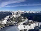
In this photo collage, I tried to capture one example. #1 and #2 (crops of the same image) were taken the moment that all red vanished from the map. The mountain peak to my left is clearly still above me. #3 was taken 4 seconds earlier (and 40 feet lower), when the map still showed a hint of red. The baro-altimeter, the photo (#1), an external GPS, and the USGS reported peak height all mostly agree. I should have had to climb another ~500 feet before the map went from red to yellow. EDIT: the map zoom/ring is set to 2nm, which is typical in this situation.
I'm trying to think of all the things that could influence this outcome.

