Map Info Setup HDX

jnmeade

Active Member
Joined
Oct 9, 2011
Messages
320
Location
Eastern Iowa
I'm thinking of how to set up the Map Info column. I understand it is largely personal preference, but am curious to know your setup to see if there are some good layouts I should emulate.
My airplane is IFR capable, and I want to support that kind of mission, but I mostly fly VFR on shorter, often direct routes.
Thanks for any observations.
Also, my Map Info column seems to be not Touch capable. Is this normal?
 

andresmith76

I love flying!
Joined
Oct 4, 2018
Messages
167
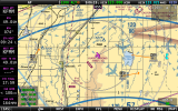
Attached is a screenshot taken from my Co-Pilot display showing how I configured my Map Info column. The top 4 boxes display my Next Waypoint info, with the next 4 showing the Final Destination info.

The 2 lower boxes show VSR/Vertical Speed Required (to Next Waypoint) and Ground Speed. Since Dynon's update of adding the AGL option, I have changed my lowest box to display this info instead of Ground Speed.

I'm not sure about the Map Info boxes being Touch Capable, as I've never tried. I searched the Installation and Pilot User Guides and find no reference that they are. If they were, what would you want to adjust/change?
 

Attachments

  • Main Screen-Co-Pilot.png
    Main Screen-Co-Pilot.png
    875.7 KB · Views: 119
Last edited:

kurtfly

I love flying!
Joined
Jun 21, 2014
Messages
282
Here is what I have mine set to. I fly IFR and VFR. I have an IFD540 for primary navigation. This works out perfect for me.
IMG_0706.jpg
IMG_0706.jpg
 
Top