Pocket FMS

dynonsupport

Dynon Technical Support
Staff member
Joined
Mar 23, 2005
Messages
13,226
Trev, In places like the UK, it's also got 5X as many airports as Jeppesen.

Richard, We do not display cities from PocketFMS. I'm not 100% sure if it's in the data they give us, but even if it is, SkyView does not understand the concept of a city right now so they are not displayed.
 

dynonsupport

Dynon Technical Support
Staff member
Joined
Mar 23, 2005
Messages
13,226
For those of you that have started using PocketFMS, thank you for your feedback.

We have been able to reproduce the issue where looking up runway information at certain airports causes SkyView to restart. This will be fixed with an update very, very shortly.

The issue with multiple airports with the same name is a more complex one that we are working on.

The issue is how PocketFMS deals with non-ICAO airports. In the picture above, EG is the ICAO country code for all UK airports, which is why all start with EG. There is an ICAO airport EGST, Elmsett.

There are multiple airports that do not have ICAO codes, and thus don't have a universally agreed upon four letter identifier. PocketFMS takes these and gives them 6 letter names, such as EGSTML. Unfortunately, we shorten this to the ICAO standard 4 letter code, and thus we get EGST, of which there are many. There's no perfect answer for these smaller airports, but we'll have something to resolve this shortly as well.

As for the confusion over what data is included, we're sorry that happened. We were careful to discuss only the data that would be included in all the Dynon press releases and other literature, but it is complex because the PocketFMS application itself can use more data than SkyView can today. The goal of adding PocketFMS support at this point was to increase the options for our customers and lower the cost, not to add a lot of new data types to SkyView.

We're continuing to work on features in the SkyView map application and you can feel confident that we are listening to all of our customer feedback.
 

trevpond

New Member
Joined
Jul 26, 2010
Messages
270
Location
Nottinghamshire U.K.
Thank you Dynon Support for your explanation. I think a lot of the issues we have with Navigation for VFR flying could be resolved by having the ability to input Waypoint positions using position references and putting our own names (names of private airfields for instance) into the Skyview routes.

Any ideas when this could happen?

best regards and of course a very happy Christmas to all at Dynon and all Skyview users. ;D ;D


Trev
 

nickbogner

New Member
Joined
Feb 22, 2011
Messages
185
Trev,

Thank you, Merry Christmas to you too.

On the PocketFMS front. The restarting bug is now fixed. We were able to fix it quickly by changing how the database is generated. All you need to do is download an updated database from PocektFMS. That is available now (the current database available for download has the fix).

We are wrapping up our game-plan to deal with the identifier issue and will have a full story shortly, standby on that...

The benefits today with PocketFMS are (1) you get more airports (the small ones you likely care about), (2) it is less expensive and (3) it adds VFR reporting points. So it might not be what you originally expected, but we still think it is a great value.

I'm glad you asked about user waypoints. Let me back up and address our overall goals and approach. We are doing several things to support more data sources and add flexibility in general. We started with Jeppesen data, and now PoceketFMS, which we are working the kinks out of (I wish we could have avoided these kinks :( ). The next addition is the user waypoint feature, it is due out in February. You will be able to add, remove and import your own waypoints as desired. So with all these changes should be a really big step forward, especially in Europe. Then, we will be adding other map features that are important to the vision we have for SkyView.

Hope all this helps.

Nick
VP Engineering & COO
 

RICHAWK

New Member
Joined
Jun 16, 2008
Messages
45
Location
uk
Thanks the full explanation of where this is going. Keep up the good work ! Hope all you guys at Dynon have a great Christmas.

Richard
 

trevpond

New Member
Joined
Jul 26, 2010
Messages
270
Location
Nottinghamshire U.K.
Nick,

Thank you very much from me and I should think just about every Skyview user. You Guys are great, you listen, and where you see sensible suggestions, you do your best to implement them. Not many companies do this and won't be diverted from the path that they have chosen; trouble is a lot of them are not Pilots, don't navigate, and work 9 to 5 and then go home and forget all about work.

Keep it up, and can't wait to see whats coming for us in 2012.

Trev :D
 

nickbogner

New Member
Joined
Feb 22, 2011
Messages
185
PocektFMS users,

Here is the official scoop regarding the duplicate identifiers...

Previous versions of the PocketFMS database on SkyView had multiple airports with the same identifier. This happened because SkyView only supports 4-character ICAO identifiers and PocketFMS uses 7 characters for many airports in Europe that are not on the ICAO system. Identifiers longer than 4 characters are truncated in SkyView. The solution is to add 7-character identifier support in SkyView. We apologize for the issue, it is receiving the utmost priority and will be solved by a SkyView firmware release and made available via the regular channel. We expect to release the software fix in February.

Until the new software version is released the PocketFMS database has the non-ICAO duplicate airports completely removed. Dynon and PocketFMS agree that missing information is preferred over wrong information. The new database with duplicates removed is available for download immediately. Users running the old database are strongly encouraged to update to this new version.

Nick
 

paul330

Member
Joined
Mar 10, 2007
Messages
107
Navigation Software

Is this intended to simply provide a better aviation database or will it interface with the Pocket FMS flight planning software? - ie can I export a Pocket FMS flightplan to the Skyview using a USB stick? If not, any plans to make it available? Somehow seems silly not to......
 

dynonsupport

Dynon Technical Support
Staff member
Joined
Mar 23, 2005
Messages
13,226
The intent here is to to have a better database in SkyView. We do have a way to import flight plans into SkyView, but they need to be in the standard GPX format that SkyView understands (documented in our manual). I don't think the PocketFMS currently outputs GPX-formatted flight plans.
 

TRCsmith

Member
Joined
Oct 24, 2006
Messages
254
Location
Suisun City, CA
I looked at some samples of Pocket FMS, not impressed! To bad Dynon couldn't team up with Anywhere map. Their data over layed on your map, Wow, almost everything you would want. :eek:
 

dynonsupport

Dynon Technical Support
Staff member
Joined
Mar 23, 2005
Messages
13,226
The point of PocketFMS is to add data support for Canada, Europe, and Australia. Anywhere Map is a USA only product, and we already have in-depth USA support. So I'm not sure what a partnership there would get us.
 

dynonsupport

Dynon Technical Support
Staff member
Joined
Mar 23, 2005
Messages
13,226
Not sure if I nailed the geographical area you're after, but here's a pretty zoomed out shot with restricted airspaces turned off (because they add to the clutter at this zoom range). Let us know if there's an airport area we can get closer in on that might help more.
 

Attachments

  • screenshot-20120204-012028-913.bmp
    1.8 MB · Views: 120

Jamie

New Member
Joined
Oct 4, 2009
Messages
105
Location
Brisbane, Australia
Thank you Dynon for that screen shot.
Can you tell me if YCAB ( Caboolture ) and YHAZ ( Hazelton ) are in the data base.
I currently have to use Ozrunways with my ipad to get these airfields and many other in my area to show up. If pocket FMS has these, I will make the change.
 

dynonsupport

Dynon Technical Support
Staff member
Joined
Mar 23, 2005
Messages
13,226
Thank you Dynon for that screen shot.
Can you tell me if YCAB ( Caboolture ) and YHAZ ( Hazelton ) are in the data base.
I currently have to use Ozrunways with my ipad to get these airfields and many other in my area to show up.  If pocket FMS has these, I will make the change.

Jamie:

We verified that YCAB is already in PocketFMS with runway and COM frequencies.

YHAZ does not appear to be in PocketFMS at the moment.

One key advantage of PocketFMS is that they are responsive to requests such as this. Just email them (info is on their website) asking that YHAZ be added.
 

tecnam2003

Member
Joined
Jun 12, 2005
Messages
41
I agree that the addition of Pocketfms is a positive step in providing useable aero information and data for those of us who live outside the USA.

However...........we still sorely lack usable land maps with detailed roads, rivers cities etc.

Is it possible for Dynon to release details of the map formats that are used so we may seek alternatives.

Using the free test trial of Pocketfms it has very detailed mapping information. If Pocketfms can compile data sets for the  aeroanutical data, why cant they also produce  land map sets for Skyview. do they need some sort of agreement with Dynon and if so is it imminent.They have an option (on the PC version) to  provide maps for the MGL products so one manufacturer has some sort of agreement with them.


It seems a shame that the final link in the chain providing synthetic vision to those outside the USA is not forthcoming.


Pocketfms is rumored to be available for android and similar products in the near future and that would suggest a possible reduced demand for Skyview as Android products could overlay multiple maps incl land details, topo, photographic, google maps etc etc. and easily switch between them.

any information about future mapping products would be much appreciated.

Kevin
NZ
 

dynonsupport

Dynon Technical Support
Staff member
Joined
Mar 23, 2005
Messages
13,226
A few notes here:

1) The USA does not have roads/rivers/cities either right now, just like it says a few posts above. We don't have a great source for data anywhere yet. We're working on it.

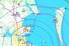
2) The data PockeFMS has are per-compiled images. This means they are huge, and pixelated at high zoom levels. It also means you can't declutter things, it's all or nothing. Additionally, they buy these from another source, so they would cost significantly more if we wanted to include them.

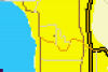
As you can see below, this is an image from PocketFMS near Seattle, with an image that is 3NM wide, and the resolution is not great.

Remember that internet connected devices don't have size restrictions. They can pre-compile images and it doesn't matter if a whole country takes up 50,000 gigabytes of data and would take months to download, because you only ever look at a small area at once.

3) It's not possible for us to release the map format because it doesn't exist. Until the software understands what a road is, there's no way for a database to show a road. Our system doesn't store images, it stores things like "an airspace of class C from lat/long A to lat/long B." So until it knows what an airspace is (or a road, river, or city) it can't draw it.

Overall, basemap details are a high priority for Dynon, and we're looking into it, but we need to find a good, solid source of data for the whole world that is affordable, and then get this folded into the software, so we can't offer any promises when this will be available.
 

Attachments

  • Resolution.png
    Resolution.png
    15.2 KB · Views: 101

Jamie

New Member
Joined
Oct 4, 2009
Messages
105
Location
Brisbane, Australia
I hope we can get this sort of detail and hi -res.
p2102537.jpg


p2102534.jpg


These are what I use with my Ipad and Ozrunways.
They use real world WAC, VTC, VNC etc charts.

This is what you need for VFR flights.
 

rong

I love flying!
Joined
Feb 12, 2012
Messages
11
HI guys. I was browsing the forum for the first time yesterday and came across this thread which relates to my role with PocketFMS looking after the AeroData for Australia, eNZed and Canada, so I though I'd make myself known.

@Jamie: We didn't receive a request to include YHAZ, but I added it yesterday and include a screengrab of our data north of Brissie.

As Nick has posted, we're happy to add any airfields that we can confirm as operational, even those not in AIP.

If there are any questions about our data, please ask. We're looking forward to the firmware upgrade which will allow our local airstrips to be shown in SkyView, although that limitation doesn't apply to Australia or Canada anyway.

Ron
 

Attachments

  • n_bris.jpg
    n_bris.jpg
    195.3 KB · Views: 112

Bruno

Member
Joined
Sep 6, 2008
Messages
220
rong   Offline
New Member
I love flying!


Posts: 1

HI guys. I was browsing the forum for the first time yesterday and came across this thread which relates to my role with PocketFMS looking after the AeroData for Australia, eNZed and Canada, so I though I'd make myself known
--------------------------------------
Hi Ron
         Nice of you to introduce yourself...

Will it be possible for you to upload a sample screen shot of a PocketsFMS   for the Montreal ( CYUL / CYMX ) area so I can have an idea of what the data will look like.??

Thanks

Bruno
Montreal,Canada..
 
Top